


Gallery-quality prints · Independent artists · Décor to adore


from $ 15


from $ 18
” by Alleycatshirts")

from $ 11
” by Alleycatshirts")

from $ 11
” by Alleycatshirts")

from $ 11
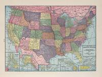
 Vintage USA Atlas” by Alleycatshirts")
from $ 11


from $ 15
” by Alleycatshirts")

from $ 11
” by Alleycatshirts")

from $ 11
” by Alleycatshirts")

from $ 11
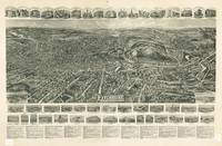
 Vintage United States Top” by Alleycatshirts")

from $ 11
” by Alleycatshirts")

from $ 11
” by Alleycatshirts")

from $ 11
” by Alleycatshirts")

from $ 11
” by Alleycatshirts")

from $ 11
 Vintage Unite” by Alleycatshirts")

from $ 11
” by Alleycatshirts")

from $ 11
” by Alleycatshirts")

from $ 11


from $ 15


from $ 15


from $ 15


from $ 15


from $ 15


from $ 15


from $ 15


from $ 15

from $ 15


from $ 15


from $ 15


from $ 15